Spatial Intelligence
Explore how spatial intelligence enables AI to perceive and navigate the 3D world. Learn to build spatially aware systems with Ultralytics YOLO26 and the Ultralytics Platform.
Spatial intelligence refers to the ability of an artificial intelligence system to perceive, understand, and navigate the physical world in three dimensions. Unlike traditional computer vision, which often analyzes 2D images as static snapshots, spatial intelligence involves reasoning about depth, geometry, movement, and the relationships between objects in a dynamic environment. It empowers machines not just to "see" pixels but to comprehend the physical context of a scene, enabling them to interact with the real world more effectively. This capability is the bridge between digital visual data and physical action, serving as a cornerstone for advanced AI agents and robotic systems.
Link to this sectionThe Core Components of Spatial Intelligence#
To achieve a human-like understanding of space, an AI system relies on several interconnected technologies and concepts.
- Depth Perception and 3D Reconstruction: Systems must convert 2D inputs from cameras into 3D representations. Techniques like monocular depth estimation allow models to predict distance from a single image, while 3D object detection helps identify the volume and orientation of items within that space.
- SLAM (Simultaneous Localization and Mapping): This allows a device, such as a robot or drone, to map an unknown environment while keeping track of its own location within it. Modern approaches often integrate visual SLAM with deep learning to improve robustness in changing lighting conditions.
- Geometric Reasoning: Beyond detection, the system must understand physical constraints—knowing that a cup rests on a table or that a door must be opened to pass through. This often involves pose estimation to track the orientation of objects or human joints in real-time.
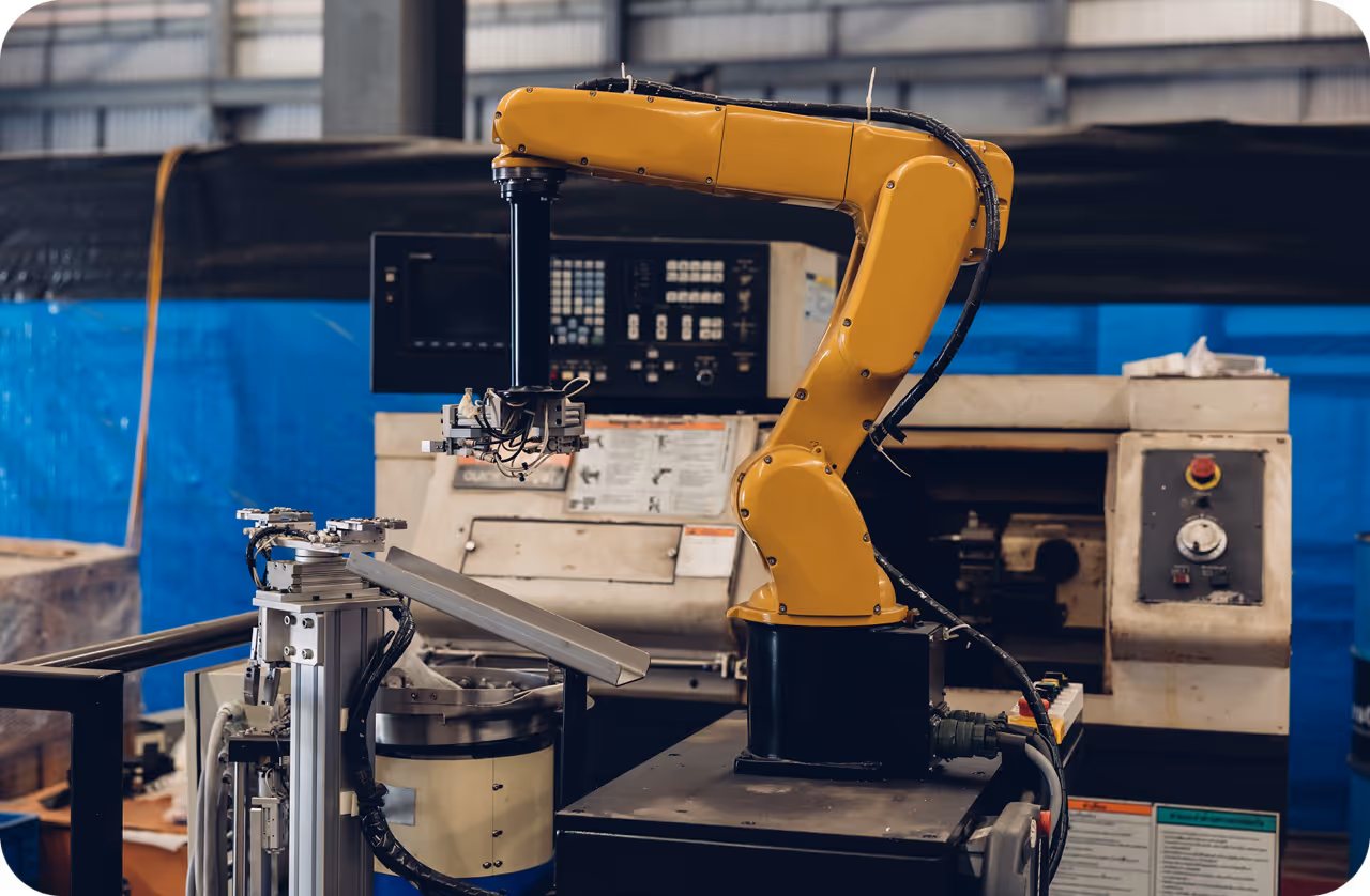
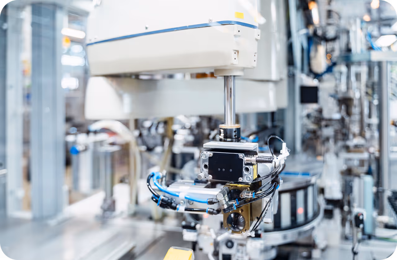
- Embodied AI: This concept links perception to action. An embodied agent doesn't just observe; it uses spatial data to plan movements, avoid obstacles, and manipulate objects, similar to how AI in robotics functions on a manufacturing floor.
Link to this sectionReal-World Applications#
Spatial intelligence is transforming industries by enabling machines to operate autonomously in complex environments.
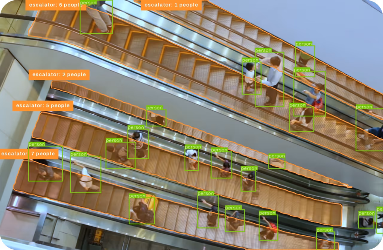
- Autonomous Robotics and Logistics: In warehousing, robots use spatial intelligence to navigate crowded aisles, identify specific packages using object detection, and place them precisely onto conveyors. They must calculate the spatial relationship between their gripper and the box to ensure a secure hold without crushing the item.
- Augmented Reality (AR) and Mixed Reality: Devices like smart glasses use spatial computing to anchor digital content to the physical world. For instance, an AR maintenance app might overlay repair instructions directly onto a specific engine part. This requires precise object tracking to ensure the graphics stay aligned as the user moves their head.
Link to this sectionSpatial Intelligence vs. Computer Vision#
While closely related, it is helpful to distinguish spatial intelligence vs. computer vision. Computer Vision is the broader field focused on deriving meaningful information from digital images, videos, and other visual inputs. It includes tasks like classification or basic 2D detection. Spatial Intelligence is a specialized subset or evolution of computer vision that specifically adds the dimension of space and physics. It moves from "What is this object?" (Vision) to "Where is this object, how is it oriented, and how can I interact with it?" (Spatial Intelligence).
Link to this sectionImplementing Spatial Awareness with Ultralytics#
Developers can build the foundation of spatial intelligence systems using the Ultralytics Platform. By training models like Ultralytics YOLO26 on tasks such as Oriented Bounding Box (OBB) detection or pose estimation, engineers can provide the necessary geometric data to downstream robotics or AR applications.
Here is a simple example of extracting spatial keypoints using a pose estimation model, which is a critical step in understanding human movement within a 3D space:
from ultralytics import YOLO

# Load a pre-trained YOLO26 pose estimation model
model = YOLO("yolo26n-pose.pt")

# Run inference on an image to detect human keypoints
results = model("path/to/image.jpg")

# Access the keypoints (x, y coordinates and confidence)
for result in results:
    # keypoints.xy returns a tensor of shape (N, 17, 2)
    keypoints = result.keypoints.xy
    print(f"Detected keypoints for {len(keypoints)} persons.")
Recent advancements in Vision Transformers (ViT) and foundation models are further accelerating this field, allowing systems to generalize spatial understanding across different environments without extensive retraining. As research from groups like Stanford's HAI and Google DeepMind continues, we can expect spatial intelligence to become a standard feature in the next generation of smart devices.