12 aerial imagery use cases powered by computer vision
Explore how computer vision converts aerial imagery into actionable intelligence for real-world aerial imagery use cases, from urban planning to security.
Every day, drones and satellites capture images of farms, cities, coastlines, forests, and infrastructure. From a bird’s eye view, they can capture subtle yet meaningful changes, such as uneven crop growth, increasing traffic congestion, shifting shorelines, or activity in monitored areas.
Many of these signals are driven by human activity, yet they are often difficult to detect from the ground. Aerial imagery makes it possible to observe these environments clearly, even in remote or hazardous locations.
However, as the volume of collected data grows, just visibility isn’t enough. Large-scale applications such as agriculture or urban monitoring can generate thousands of images, making manual review slow, labor-intensive, and impractical.
Computer vision technology provides a better alternative by automating this analysis and review process. Vision AI is a field of artificial intelligence (AI) that enables machines to interpret and understand visual data. In particular, computer vision models can detect and classify objects, map precise boundaries, and track movement across vast amounts of aerial imagery in real time, enabling consistent, scalable change monitoring.
In this article, we’ll explore why computer vision is essential for smart aerial imagery systems and walk through 12 aerial imagery use cases where visual data can be transformed into actionable intelligence. Let’s get started!
Link to this sectionTurning aerial imagery into actionable insights with computer vision#
Aerial imaging systems generate tons of spatial data. For instance, a drone flying over a city can capture thousands of high-resolution aerial photographs of city blocks and human activity.
Similarly, satellite imagery can provide a stream of continuous visual data. Manually reviewing this data can be difficult. Often, image analysis has to be done quickly and precisely, especially when it comes to use cases such as earthquake damage assessment, where time is critical.
Computer vision makes it easier to handle such data by converting drone and satellite imagery into information a machine can understand. Vision AI solutions work by feeding the captured visual data into computer vision models, which then perform various vision tasks. These include detecting objects, mapping large areas of interest, and tracking changes over time.
Models like Ultralytics YOLO26 are designed for real-time vision tasks like object detection, instance segmentation, and object tracking. They can process imagery efficiently on small devices or across large geographic regions, making it possible to convert live aerial data into actionable insights as soon as it is captured.
Link to this sectionCore computer vision tasks for aerial imagery use cases#
Here’s a closer look at some common computer vision tasks used to extract meaningful insights from aerial imagery:
- Image classification: This task assigns labels to entire images, such as crop types, land cover categories, or environmental conditions, making it easier to organize and filter large aerial datasets.
- Object detection: Specific items of interest, including people, vehicles, buildings, or animals, can be identified and localized within an image using object detection. This task forms the foundation for many aerial analysis workflows.
- Instance segmentation: It can be used to map precise object boundaries at the pixel level, which is essential for applications such as agriculture and environmental monitoring that require detailed area measurements.
- Object tracking: Building on detection, object tracking follows identified objects across multiple frames or time periods. This provides insight into movement patterns and changes over time, which is critical for monitoring dynamic scenes.
- Oriented bounding box (OBB) detection: With respect to aerial images where objects appear at different angles, oriented bounding boxes can capture object orientation and shape more accurately, improving detection quality for objects such as ships, vehicles, and infrastructure.
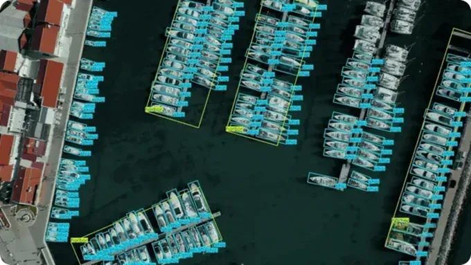
Fig 1. An example of using YOLO for OBB detection (Source)
Link to this section12 real-world aerial imagery use cases driven by computer vision#
Now that we have a better understanding of computer vision in aerial imagery, let’s discuss some real-world aerial imagery applications where vision AI may be used.
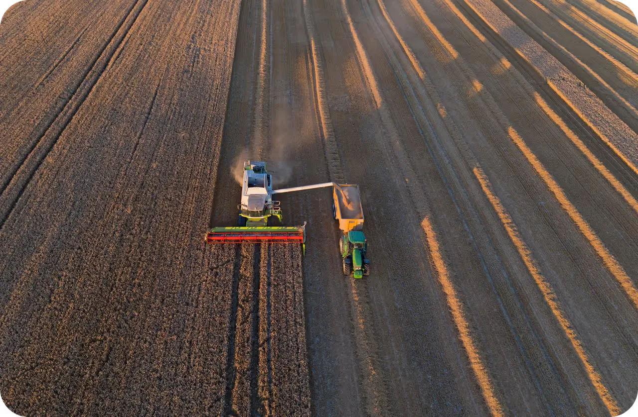
Link to this section1. Irrigation management and precision agriculture#
Water issues often develop slowly and go unnoticed in agriculture. Issues such as irrigation leaks, uneven water distribution, and crop water stress can build up over time without obvious signs. By the time crop damage becomes visible, farmers lose yield.
Aerial imagery can be used to monitor entire farmlands at once. From above, changes in crop health and moisture are much easier to detect than through ground inspections.
This data can be analyzed by computer vision to separate crop areas and detect issues such as dry patches or over-irrigated zones. This allows early action, better water use, and higher crop yields at lower cost.
Link to this section2. Earthquake and landslide damage assessment#
Even a slight delay in decision-making can negatively impact rescue and response efforts during a natural disaster. Disasters such as earthquakes and landslides often result in unstable buildings and blocked roads, complicating rescue efforts by making some areas inaccessible. This can make traditional ground-based inspections slow, dangerous, or sometimes impossible.
Remote sensing enabled by aerial data and satellite imagery gives response teams a rapid, wide-area view of affected regions. Within minutes, they can see collapsed buildings, damaged roads, and the most impacted areas without waiting for physical access.
Computer vision systems can provide additional support to the rescue teams by using this aerial data to identify damaged structures and blocked routes. Systems integrated with models like Ultralytics YOLO26 can be trained to detect landslides, debris, and road obstructions directly from aerial imagery. This helps rescue teams respond faster and allocate resources more effectively during disaster management.
Link to this section3. Smart city compliance auditing and change detection#
Urban violations such as illegal dumping, land misuse, and public space encroachment often happen without anyone noticing. By the time they are noticed on the ground, the issue has likely spread across multiple areas.
Aerial imagery streamlines monitoring such issues in urban areas. For instance, regular overhead drone imagery provides a clear, up-to-date view of streets, open land, and public spaces that are difficult to access through manual inspections.
Vision AI models can be used to analyze these aerial photographs to detect waste sites and unauthorized structures. When combined with geographic information systems (GIS) and zoning data, city officials can track how violations accumulate over time, identify similar areas, and enforce maintenance rules more effectively.
Link to this section4. Road network and traffic analysis#
Managing road networks is tricky when visibility relies solely on ground sensors and fixed cameras. Although they can highlight isolated points of concern on the road, they struggle to capture how traffic behaves across an entire city.
High-resolution aerial imagery solves this by showing roads, intersections, and traffic flow in a single view. Using this method, it is easier to detect bottlenecks, traffic buildup, and illegal parking than with ground-based systems. When aerial systems are integrated with vision models like the Ultralytics YOLO models, they can help analyze traffic over large areas.
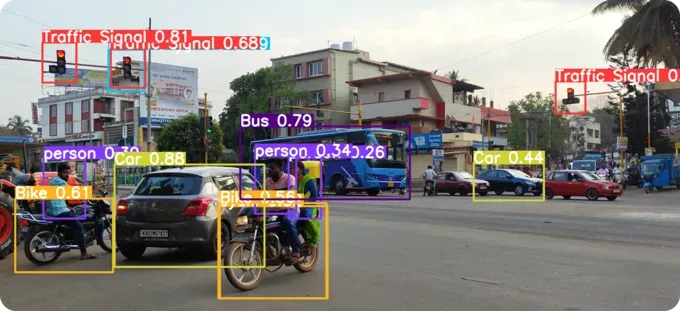
Fig 2. Using YOLO models to analyze traffic conditions (Source)
Link to this section5. Property surveying and real estate valuation#
Accurate measurements are essential when land and buildings are surveyed for valuation, planning, or regulatory purposes. Manual surveys can be time-consuming, especially across large or hard-to-access properties, and even small inconsistencies may lead to delays or follow-up work.
Drones and other aerial platforms help by capturing up-to-date imagery of properties from above. When combined with photogrammetry and LiDAR, this imagery can generate detailed three-dimensional models of the land and surrounding structures, reducing the need for frequent site visits.
Computer vision supports this process by assisting with tasks such as identifying visible property features, outlining approximate boundaries, and measuring distances or areas from the imagery. These outputs are typically reviewed and validated by surveyors, helping teams work more efficiently while maintaining accuracy.
Link to this section6. Aerial photography for more cinematic storytelling#
In some situations, traditional filmmaking tools like camera rigs and cranes can limit how certain shots are captured, especially when wide views or fast, dynamic movement are needed. Drones help overcome these limits by enabling smooth aerial shots across large spaces.
They give filmmakers the freedom to capture sweeping landscapes, complex action scenes, and overhead tracking shots that are difficult to achieve from the ground. Computer vision-enabled drones can also be used to track objects in high-resolution imagery, allowing the camera to smoothly follow moving subjects such as a vehicle. This reduces the need for constant manual control and helps crews capture stable, cinematic footage more efficiently.
Link to this section7. Border and perimeter monitoring#
Monitoring large border and perimeter regions can be challenging due to vast terrain, remote locations, and limited ground access. Maintaining consistent coverage in these areas often requires significant resources and can still leave visibility gaps.
Aerial imaging systems can be a scalable way to improve situational awareness across wide regions. Drones and other aerial platforms can collect imagery that provides continuous visibility without requiring constant on-ground presence.
Computer vision techniques can be used to analyze this data to identify patterns of movement, such as people or vehicles, track changes over time, and highlight irregular activity. This helps organizations improve response times and allocate resources more effectively.
Link to this section8. Wildlife population monitoring#
Traditional wildlife surveys, such as ground patrols or low-altitude flights, can disturb animals and often result in gaps in data collection, especially across large or remote habitats. These methods can also be difficult to scale consistently over time.
Aerial systems are a less intrusive way to monitor wildlife. Drones equipped with multispectral sensors enable teams to observe animals from a distance and support more consistent data collection, even in dense vegetation or low-light conditions.
Computer vision models can then analyze this imagery to assist with tasks like detecting and counting animals, helping teams allocate resources more effectively, and make better informed decisions for habitat protection and conservation efforts.
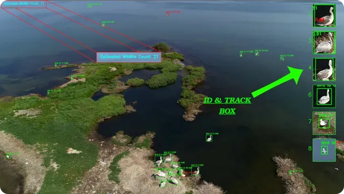
Fig 3. Using vision-based drone footage for bird counting (Source)
Link to this section9. Improving mine safety with aerial monitoring#
Mining sites often involve heavy machinery and changing terrain, which can make routine inspections time-consuming. Relying only on ground-based inspections may also require more frequent site access.
Satellite and aerial imagery lets inspectors and operators view entire mining sites from above. This broader perspective makes it easier to observe changes in pit boundaries, haul roads, stockpiles, and equipment locations compared to ground-level checks.
Computer vision supports this process by detecting and outlining visible elements such as vehicles, stockpiles, haul roads, and pit boundaries. This allows teams to focus inspections on specific locations, reduce unnecessary site visits, and maintain consistent safety oversight.
Link to this section10. Forest fire detection and spread analysis#
Forest fires can spread quickly, sometimes even faster than ground teams can respond. By the time fires are reported, large areas may already be affected.
Using drones and satellite imaging systems, it is easier to detect fires early across large forest areas. They also support environmental monitoring, even in areas with limited ground access.
Specifically, computer vision models can detect smoke and flames and track how fires spread over time. Such systems can also support rapid damage assessment, helping response teams act faster and limit long-term impact.
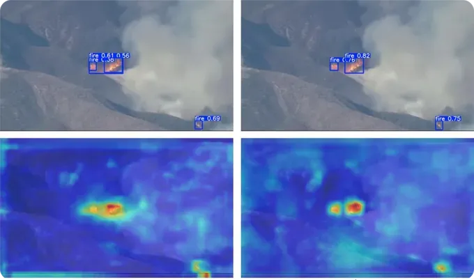
Fig 4. Detecting forest fires using aerial images (Source)
Link to this section11. Port and harbor monitoring#
Ports deal with constant vessel movement, tight schedules, and limited space, which makes it hard to see everything that is happening at once. Traditional monitoring methods often miss real-time activity, such as container movement or traffic buildup.
Aerial or drone imagery offers a simple way to get a clear view of port operations from above. It can show where ships are located, how traffic is moving, and where congestion is forming across the harbor. Vision AI can then analyze this imagery to track vessels and spot congestion early, helping ports manage traffic more smoothly and keep operations running efficiently.
Link to this section12. Oil spill detection#
Oil spills are difficult to identify in their early stages, especially across large ocean areas. By the time they are reported, the spill may have already spread and harmed the surrounding ecosystem.
The bird’s-eye view of drones provides clear visuals of open water. As a result, changes in surface color and texture are easier to see from a higher elevation.
This imagery can be analyzed using computer vision to detect and segment spills early and track how they spread. It means faster containment and helps reduce long-term damage to marine ecosystems.
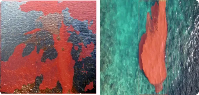
Fig 5. Oil spill detection using vision AI (Source)
Link to this sectionKey takeaways#
When combined with computer vision, aerial imagery becomes more than static visuals and starts delivering practical insights. As data volumes grow, these systems are becoming faster and more automated, with analysis happening closer to the time of capture. This shift is moving aerial imagery from simple observation toward more informed and timely decision-making.
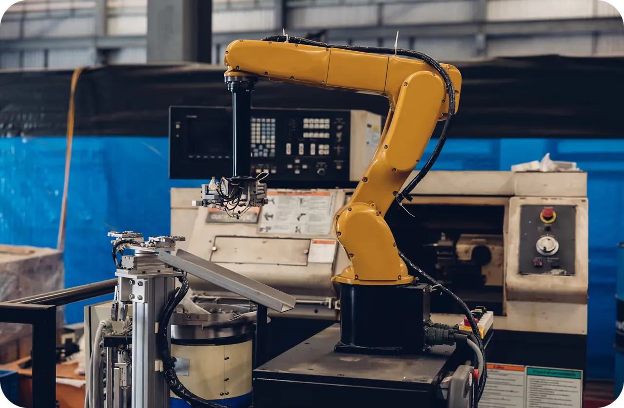
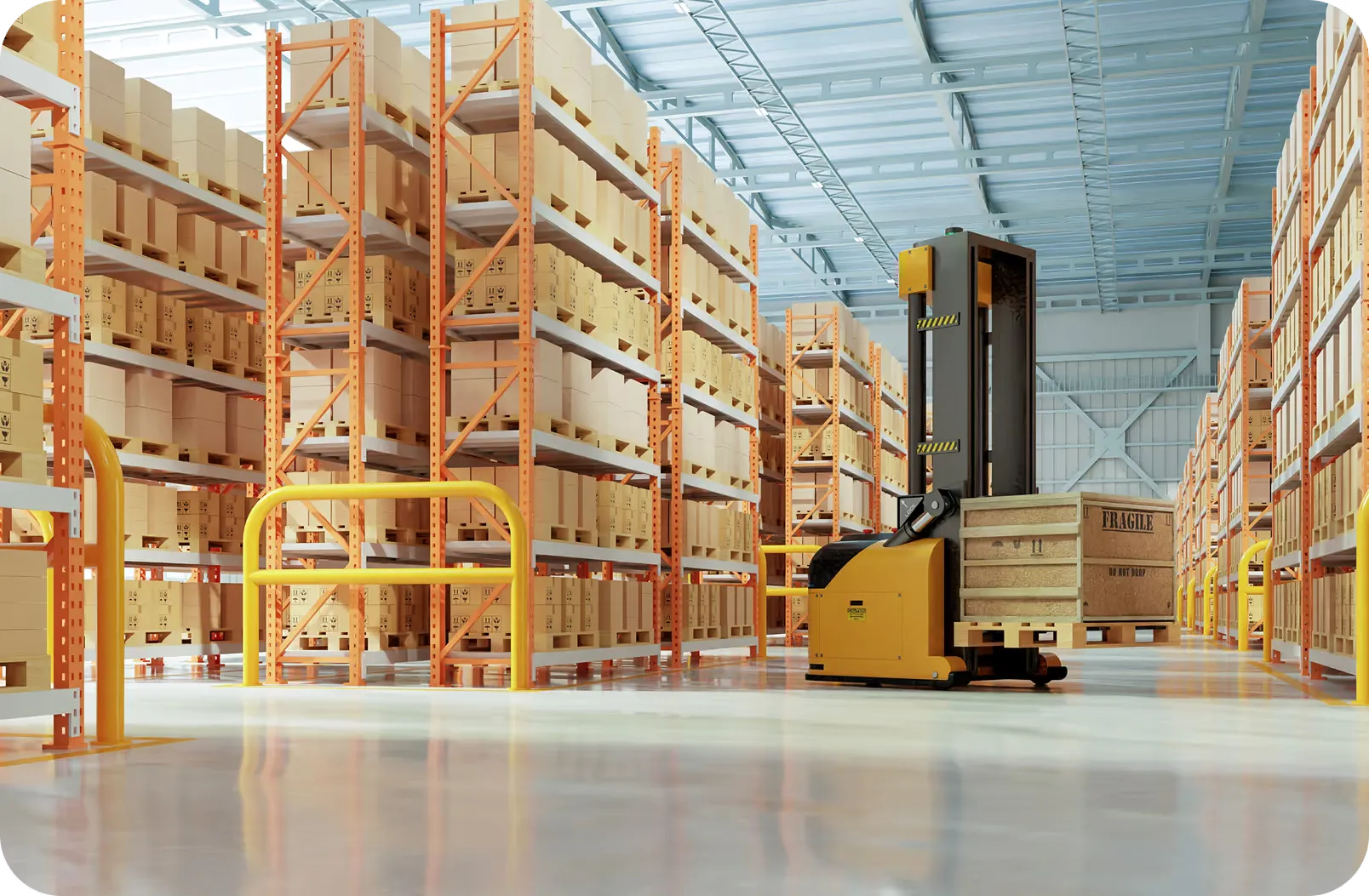
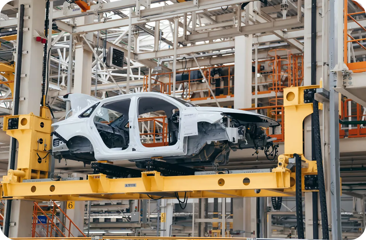
Join our growing community! Explore our GitHub repository to learn more about AI. Discover computer vision in manufacturing and AI in logistics by visiting our solution pages. To start building with computer vision, check out our licensing options.