Computer vision for aerial imagery
Transform drone and aerial imagery into real-time insights for agriculture, aquaculture, environmental monitoring, conservation, and geospatial analysis with Ultralytics YOLO.
Trusted by the world's leading organizations












How Ultralytics YOLO tackles aerial imagery
See more from above with vision AI
Ultralytics YOLO helps organizations detect, classify, segment, and monitor objects captured by drones and other aerial platforms. Build accurate models and deploy them in the cloud, on edge devices, or directly within autonomous systems.
- Plug-and-play deployment: Deploys with minimal overhead, cutting integration time to days.
- Detection accuracy: State-of-the-art real-time detection across objects, environments, and dynamic scenes.
- Sub-5ms inference: Edge, cloud, or on-premise deployment with 22 export formats.
- Production-ready in hours: Annotate, train, and deploy reducing time-to-market.

Measured results from aerial vision workflows
Peer-reviewed aerial-imagery studies using Ultralytics YOLO report measured results across precision spraying, forest health, and aerial asset inspection.
Try YOLO26 inference
Drag and drop an image to see real-time object detection
Turn aerial imagery into actionable intelligence
Purpose-built solutions for every stage of your production process.
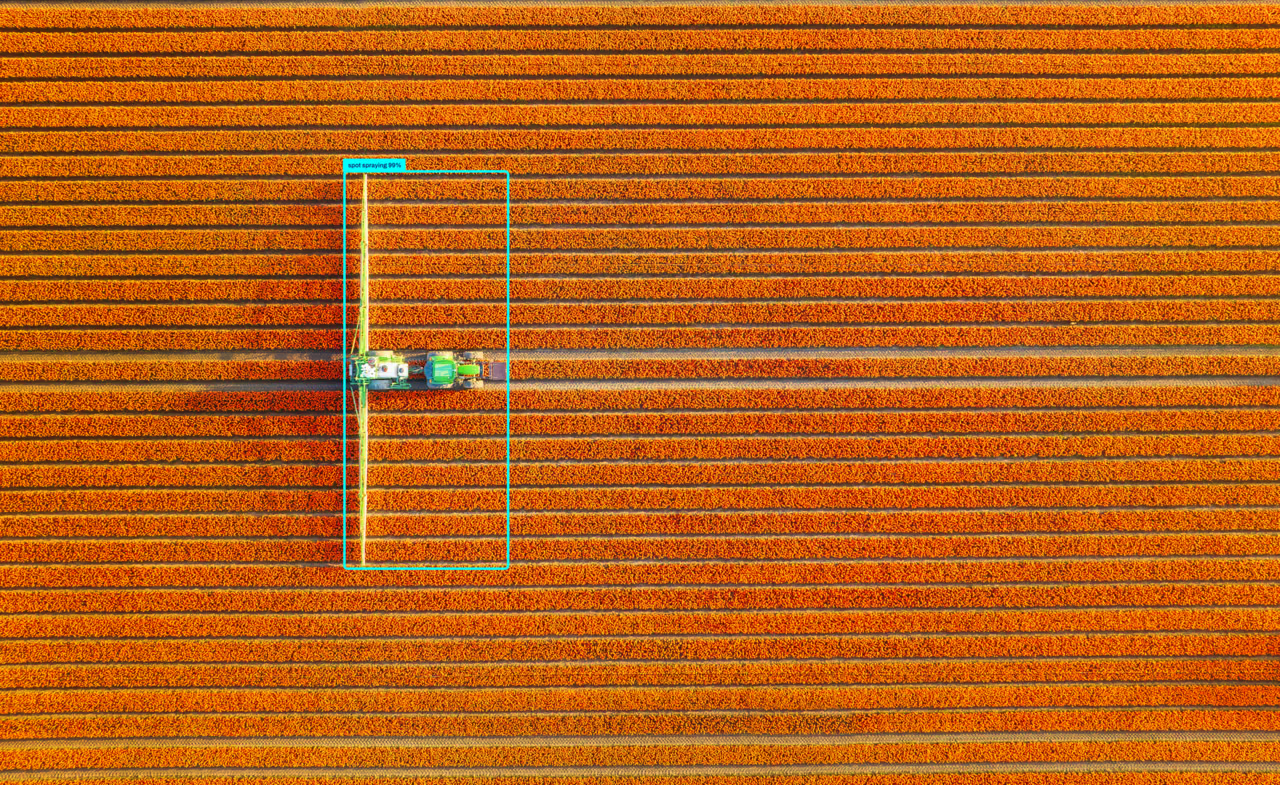
Spray smarter with Ultralytics YOLO
Leverage Ultralytics YOLO to identify crops and weeds in real time, enabling targeted fertilizer application that reduces chemical use and protects healthy plants.
- Weed identification: Detect weeds from crops across varying field conditions.
- Targeted application: Guide precision spraying to exact plant locations, not entire fields.
- Reduced chemical use: Cut herbicide costs and environmental impact with selective spraying.

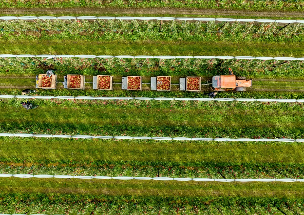
Count and classify fruit with precision
Leverage Ultralytics YOLO to detect, count, and classify fruit, supporting accurate yield estimation, harvesting decisions, and quality monitoring.
- Yield estimation: Count fruit across orchards to forecast harvest volume.
- Ripeness classification: Identify fruit ready for harvest versus still maturing.
- Quality monitoring: Flag damaged or defective fruit before it reaches processing.
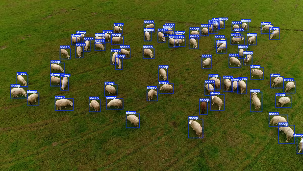
Monitor farms from above
Leverage Ultralytics YOLO to detect, count, and monitor livestock, equipment, and field activity using imagery captured across farms and remote land.
- Livestock tracking: Count and monitor animals across large or remote pastures.
- Equipment detection: Locate and monitor machinery and assets across the farm.
- Activity monitoring: Track field activity to support operational decisions.
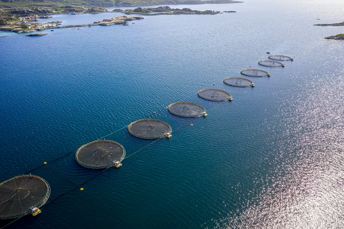
Keep aquaculture operations under watch
Leverage Ultralytics YOLO to monitor fish populations, feeding activity, water-based infrastructure, and operational conditions across aquaculture facilities.
- Population monitoring: Track fish counts and behavior across pens and tanks.
- Feeding analysis: Monitor feeding activity to optimize feed efficiency.
- Infrastructure checks: Detect issues with nets, pens, and water-based equipment.
Protect wildlife with aerial vision AI
Leverage Ultralytics YOLO to detect, classify, and count, wildlife across large or difficult-to-access habitats, reducing reliance on manual surveys.
- Species classification: Identify and classify wildlife species from aerial footage.
- Population counting: Count animals across habitats without ground surveys.
- Habitat tracking: Monitor animal habitats in remote or protected areas.
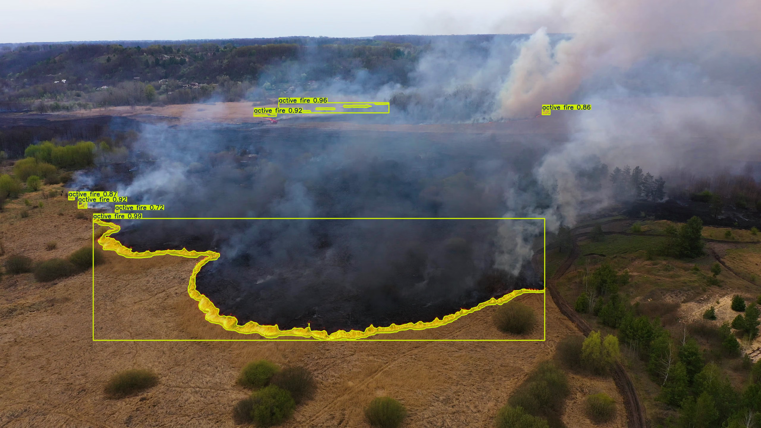
Choose from 22 export formats
Train once, deploy everywhere, from edge microcontrollers to cloud GPU clusters.
Transforming industries with vision AI
From factory floors to operating rooms, Ultralytics turns visual data into real-time decisions.
RTM cuts inference cost 28% with Ultralytics YOLO26
SK Godelius detects 3,400 defects on mining conveyors with Ultralytics YOLO

Camerite cuts development time 25.2% with Ultralytics YOLO
OnsiteIQ reduces project delays by 20% with Ultralytics YOLO11
mtrail's TrainVision cuts rail data collection time by close to 100%

Glacier Robotics reduced PET leakage by 70% across US recycling facilities
SOHGA cuts parking monitoring time by 30% with Ultralytics YOLO

Scaleout cuts model updates from weeks to hours with Ultralytics YOLO
RapiD Engineering deploys seafood quality control 1 week faster with Ultralytics YOLO
Project Ocean Oasis advances reef conservation with Ultralytics YOLO
Volley powers 250+ on-court AI trainers with Ultralytics YOLO
WG Tech Solutions cuts safety violations by 28% with Ultralytics YOLO and Axelera’s AI Accelerator
Stride delivers 1-minute equine gait analysis with Ultralytics YOLO

Pixelabs achieves 95% recall with Ultralytics YOLO-driven automation

SiteAssist improves site safety by processing 770K+ images with Ultralytics YOLO
Chef Robotics uses Ultralytics YOLO to cut food giveaway by 67%
Cali Intelligence shortens checkout queues by 43% with Ultralytics YOLO
MarineSitu hits 96%+ uptime in underwater monitoring using Ultralytics YOLO
Theia Scientific speeds up microscopy analysis 43× with Ultralytics YOLO
eSmart Systems halves power line inspection time with Ultralytics YOLO

Axelera AI delivers 34 FPS edge AI inference using Ultralytics YOLO

STMicroelectronics runs Ultralytics YOLO on an MCU at just 9.4 mJ per inference

Specialvideo reaches 99% food inspection accuracy with Ultralytics YOLO
Vivity AI saves $5M+ a year in industrial operations with Ultralytics YOLO
Videologic Analytics scales to 10K AI camera licenses with Ultralytics YOLO

Prezent boosts slide detection accuracy by 34% with Ultralytics YOLO
ALYCE accelerates traffic AI inference by 20% with Ultralytics YOLO
Kiwitron uses Ultralytics YOLO to detect industrial hazards 30m away
Enterprise-grade security, certified
Independently certified and audited, so your data stays protected in transit and at rest.

SOC 2 Type I

ISO 27001:2022

GDPR & CCPA
Frequently asked questions
Computer vision for drones uses AI models to automatically detect, classify, segment, and track objects in images and video captured from aerial platforms. Ultralytics YOLO processes this imagery to identify crops, animals, infrastructure, and environmental features without manual review.
Yes. YOLO models can be deployed on edge devices and onboard drone hardware for real-time, in-flight analysis, or run imagery through on-premise and cloud infrastructure for post-flight processing of high-resolution data.
YOLO models detect crops and weeds for targeted spraying, monitor plant health and disease signs, and support fruit detection, counting, and classification for yield estimation and harvest planning across large fields.
Yes. YOLO can detect, classify, count, and track livestock, fish, and wildlife from aerial imagery, supporting farm monitoring, aquaculture operations, and conservation surveys across large or hard-to-reach areas.
Common industries include agriculture, aquaculture, environmental monitoring, and land conservation, alongside infrastructure inspection, security and surveillance, defense, and satellite and geospatial analysis, where aerial platforms capture imagery for scalable, automated monitoring.
Ultralytics YOLO supports object detection, oriented bounding boxes, image segmentation, classification, pose estimation, depth estimation, and object tracking across both still images and video captured from drones and aerial devices. Oriented bounding boxes matter most for aerial work, because objects seen from above sit at any angle, so aircraft, ships, vehicles, and buildings are detected at their true orientation rather than boxed off square.
Build smarter aerial systems with Ultralytics YOLO
From precision agriculture and aquaculture to geospatial intelligence and wildlife conservation, turn aerial data into decisions with fast, accurate computer vision.